Hydromorphology
Kathmandu, October 2020by Korbinian Enzinger
Supervised by Prof. Claudia Pasquero
and Maria Kuptsova
The project aims to respond to the trend of humans to shape landscapes through anthropocentric environmentalism meaning that the primary goal of conserving the environment lies in the exploitation by and from human purposes. With a quickly growing global population, especially since the turn of the 20th century, the impact of anthropocentric environmentalism on the biosphere became increasingly significant. The philosophic idea of “deep ecology” is that our ecosystem is formed by interrelationships between many organisms that depend on each other.
[..] “it recognizes diverse communities of life on Earth that are composed not only through biotic factors but also, where applicable, through ethical relations, that is, the valuing of other beings as more than just resources.”
Smith, Mick (2014). “Deep Ecology: What is Said and (to be) Done?”
According to the International Institute of Water Management in Kathmandu, Nepal has 2.7 % of the available fresh water on Earth, making it the second country, after Brazil, with more water reserves in the world. The 8.6 million cubic meters of water that flow from the Himalaya peaks through the Nepali valleys every year provide each of its inhabitants an annual availability of 9000 cubic meters (9 million liters). This is one of the highest rates in the world, much higher, for instance, than the one in India, which reaches 1431 cubic meters.
The thaw of nearly 3000 glaciers and lakes in the highest mountains of the Earth feeds over 6000 rivers and streams that flow through the Nepal valleys. This enormous flow supplies water to over one Billion inhabitants downstream, in India and Pakistan. However, nearly 5 million inhabitants of Nepal, 18% of the population, do not have access to safe sources of drinking water, and 30.9% lives below the poverty threshold, according to data of the United Nations Development Program.
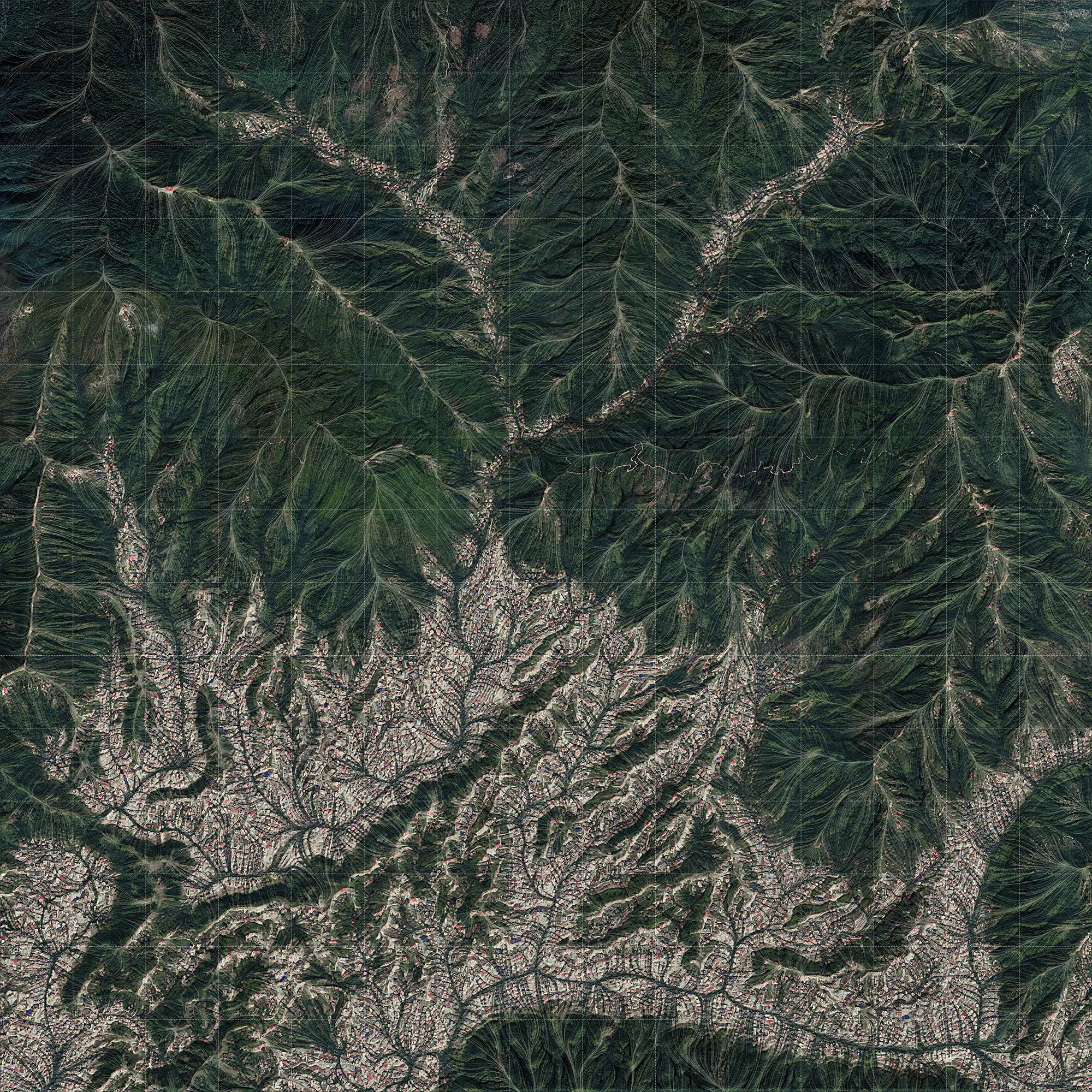
Since 27% of the population in Nepal does not have access to improved sanitation the excisting surface water is exposed to pollution through industry, agriculture as well as the discharge of untreated sewage from dense urban areas, making it unsuitable as a safe souce of drinking water. As a result ground water is becoming the major source of drinking water putting an immense stress on the ground water levels and the ecology depending on it. Looking at the land distribution and rate of urban sprawl in the metropolitain region of Kathmandu it becomes obvious that this trend is likely to worsen if no countervailing measures are undertaken.
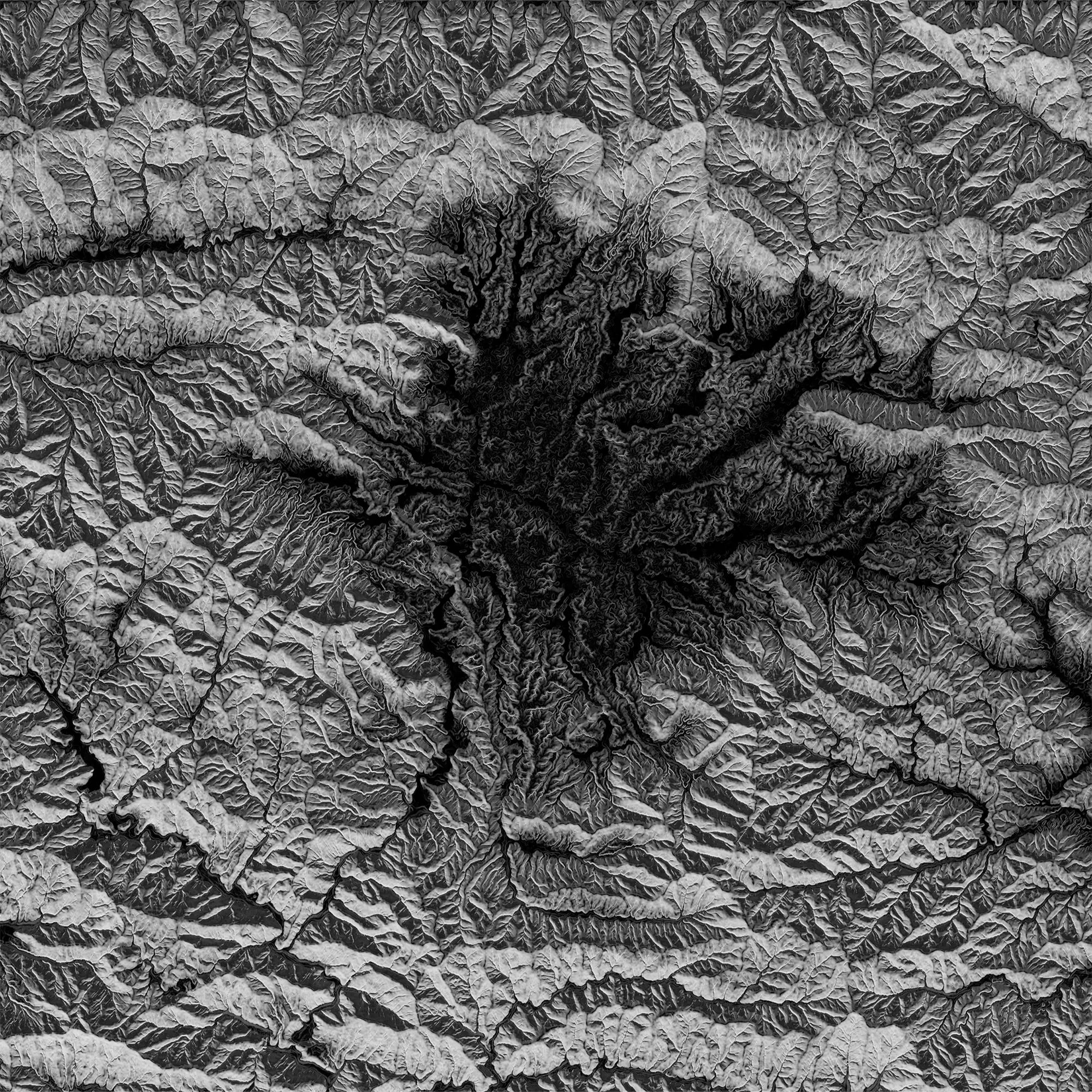
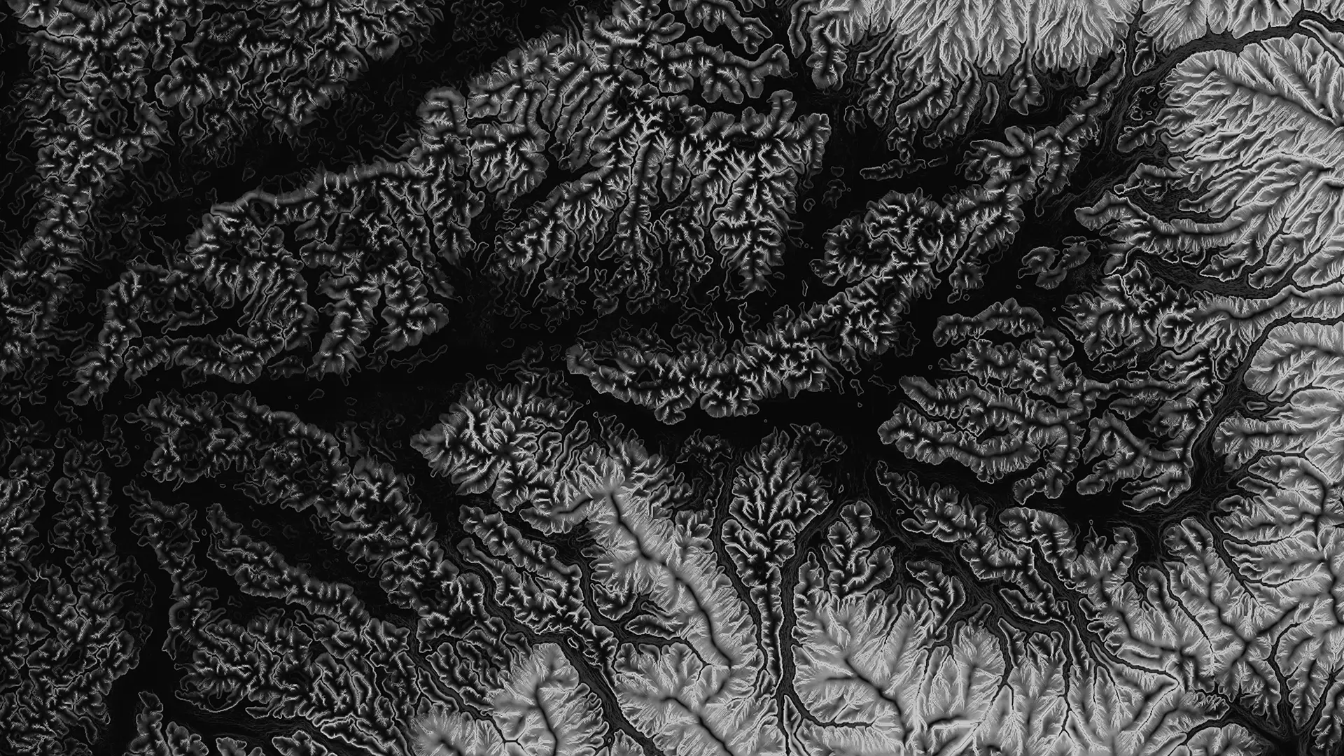
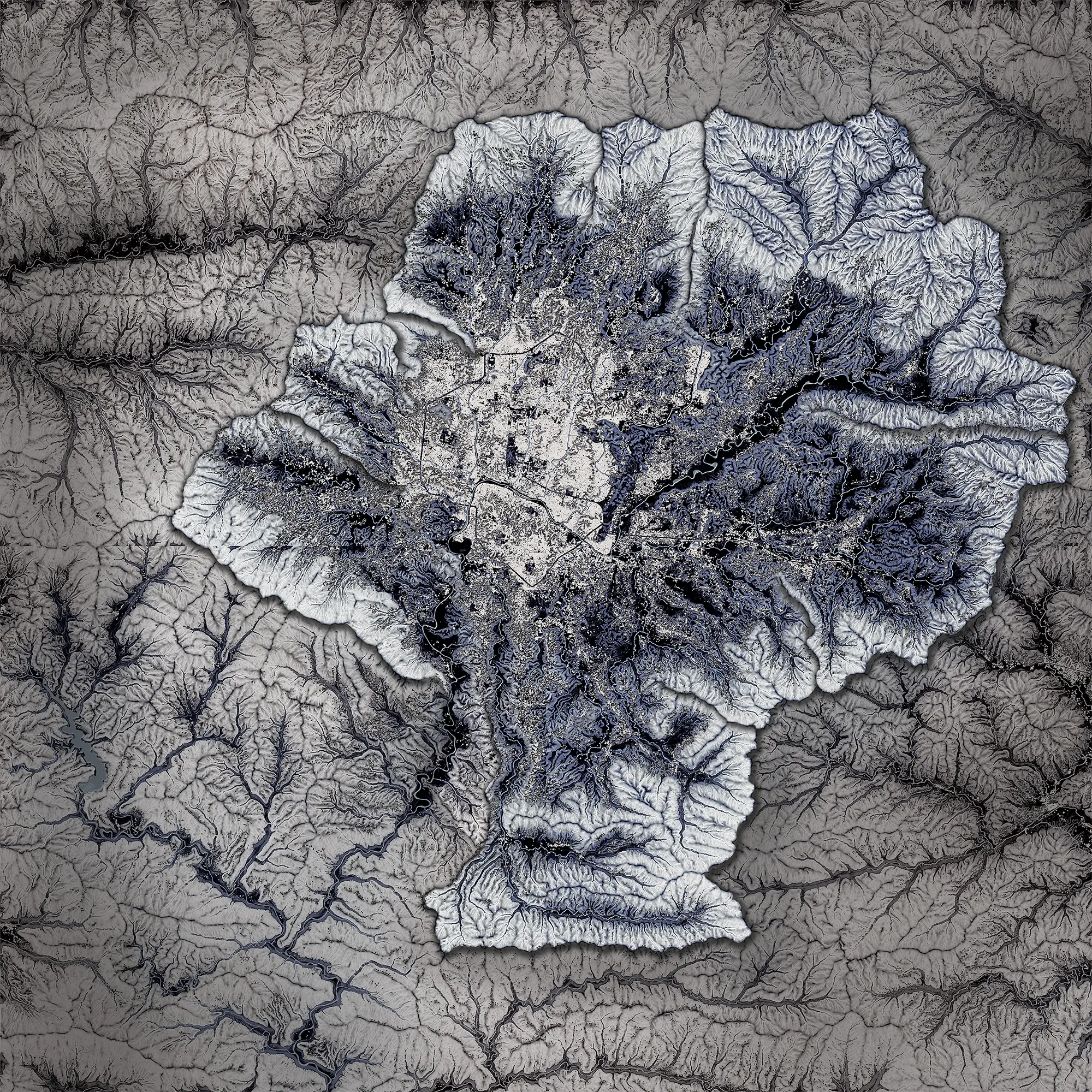
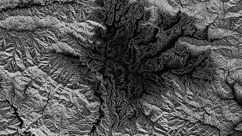
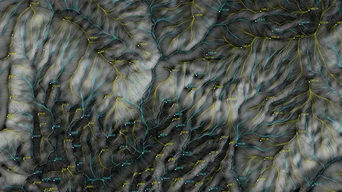
This map of the Kathmandu valley was modified with different erosion techniques to enhance the awareness how the process of water dynamics and the accompanying morphology of the landscape behaves over time. Additionally the shading of the map conveys information about the slope of the topography reduced to a black and white image. The lightest areas represent the steepest slopes and therefore the highest rates of surface water runoff. On the other hand the black areas depict the rather flat areas with slower surface water runoff allowing higher rates of groundwater recharge. this map lets us conceive valuable information about hydromophological processes independently from human interventions.
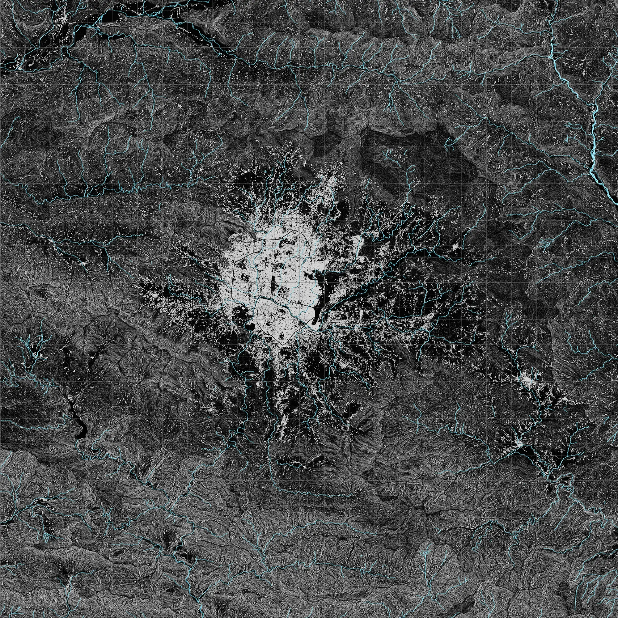
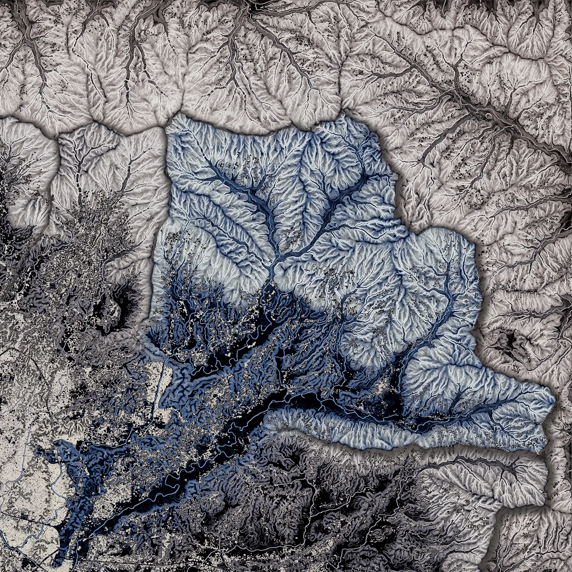
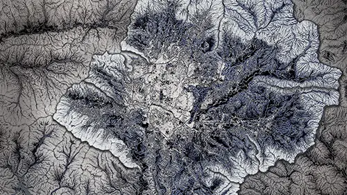
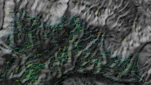
Over the course of the past century the human impact on the environment became increasingly significant, making it impossible to analyse hydrological processes without involving human networks. This map adds the Anthropocene as an extra layer of information involving houses and street networks. unfortunately the areas with the highest potential for groundwater recharge are also the areas best suited for urban development, leading to a negative effect on the hydrology. The sealing of the soil surface not only leads to an increased surface water run-off and lowering of the groundwater level but also to a higher risk of flooding.
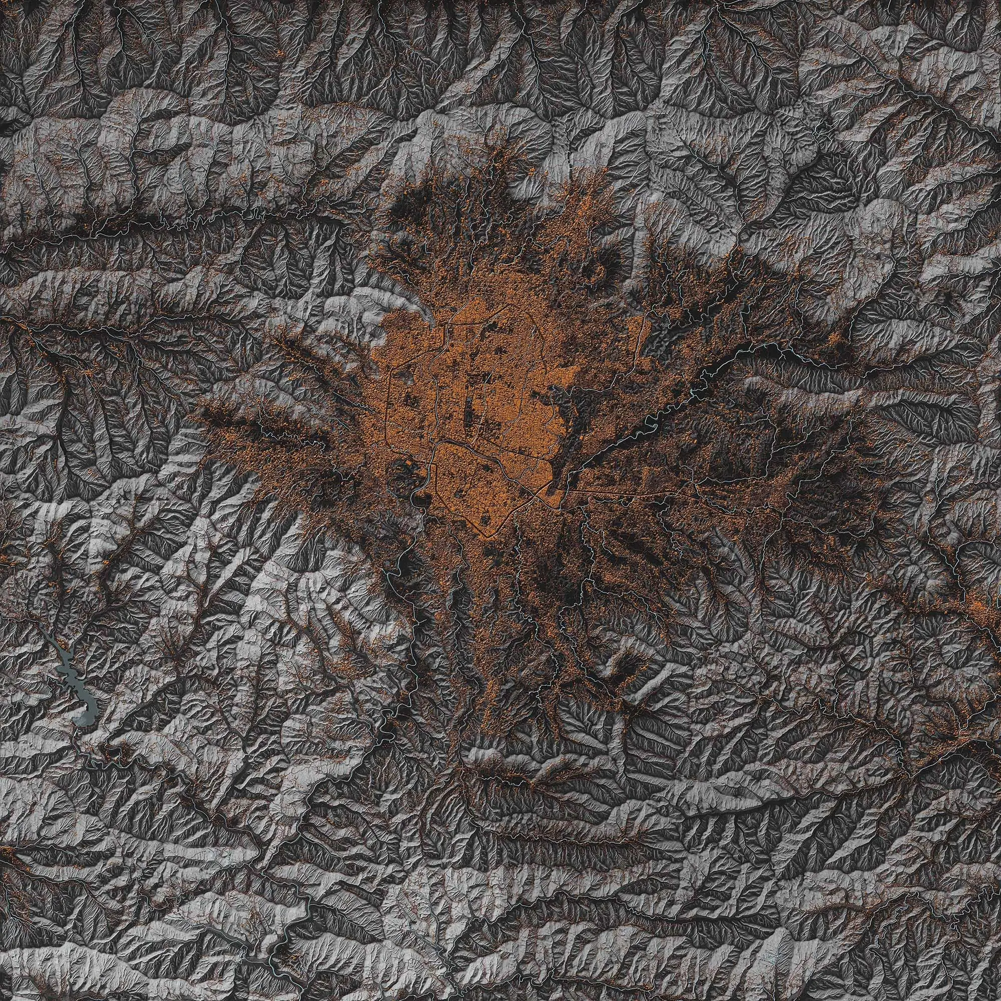
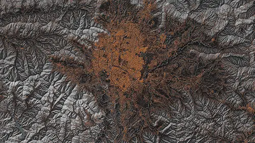
Since water is the main impulse of morphologic processes of the topography and the source for all living beings (humand as well as non-human) it is vital to set it in the focus of attention when trying to develop a new strategy of a sustainable urban sprawl. It is important to understand where the water comes from and what the major influences on the water quality are. This drawing illustrates how the water quality decreases depending on the density of the built-up urban environment. Clarifying these hydromophological processes and using them as a base map is used as a foundation for the development of a new network that allows human and non-human networks to interact with each other to form a “true democracy” that incorporates nature as a indispensable part of the world we live in.
My proposal aims to show an alternative city distribution that is designed based on different data inputs from my analysis. The goal of this redistribution is to reduce the stress on the surface water quality caused by pollution, offering a safe source of drinking water for the people of Kathmandu as well as reducing the risks of flooding and landslides.
For this to work, a water distribution system is needed that allows me to freely distribute water to any desired point of the Valley. I was inspired by the “Water Elevating Towers”, a low tech approach that has been used in the late 19th century in Tamesloht, Morocco. It is an alternative to an Aqueduct that uses the hydrostatic pressure to transport water from one side of a valley to another. I adapted this linear approach of transporting water to apply to the 3D topography of the Kathmandu Valley.
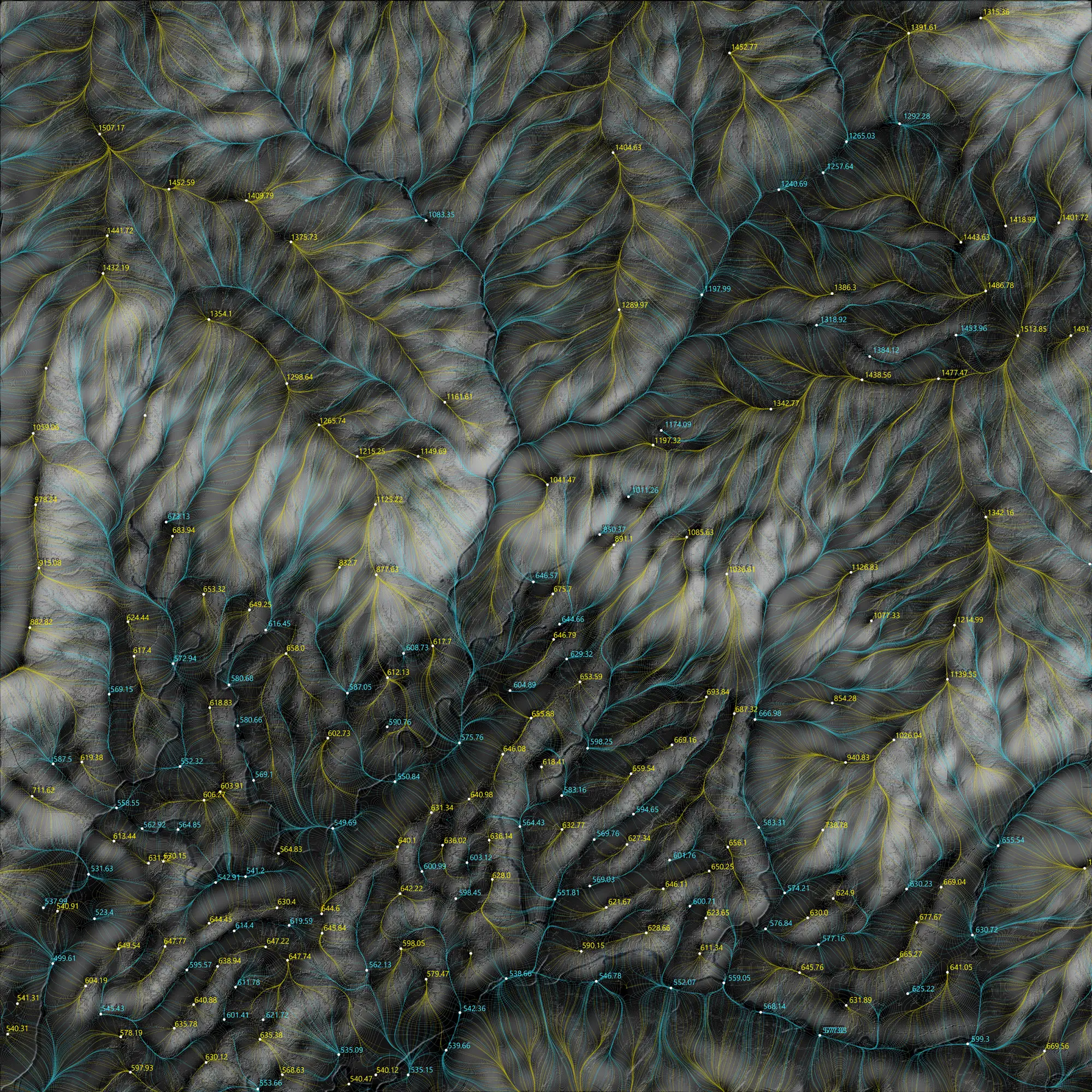
A script was developed to calculate local high and low points on the topography through a flow line analysis. Water is absorbed at the low points and transported to the next high points at a lower elevation through hydro-static pressure. from these locations water can be redistributed again to its surrounding environment to provide a safe source of water to households as well as agriculture. As a result we get a network for a water distribution system that can cover the entire Kathmandu Valley without any additional input of energy.
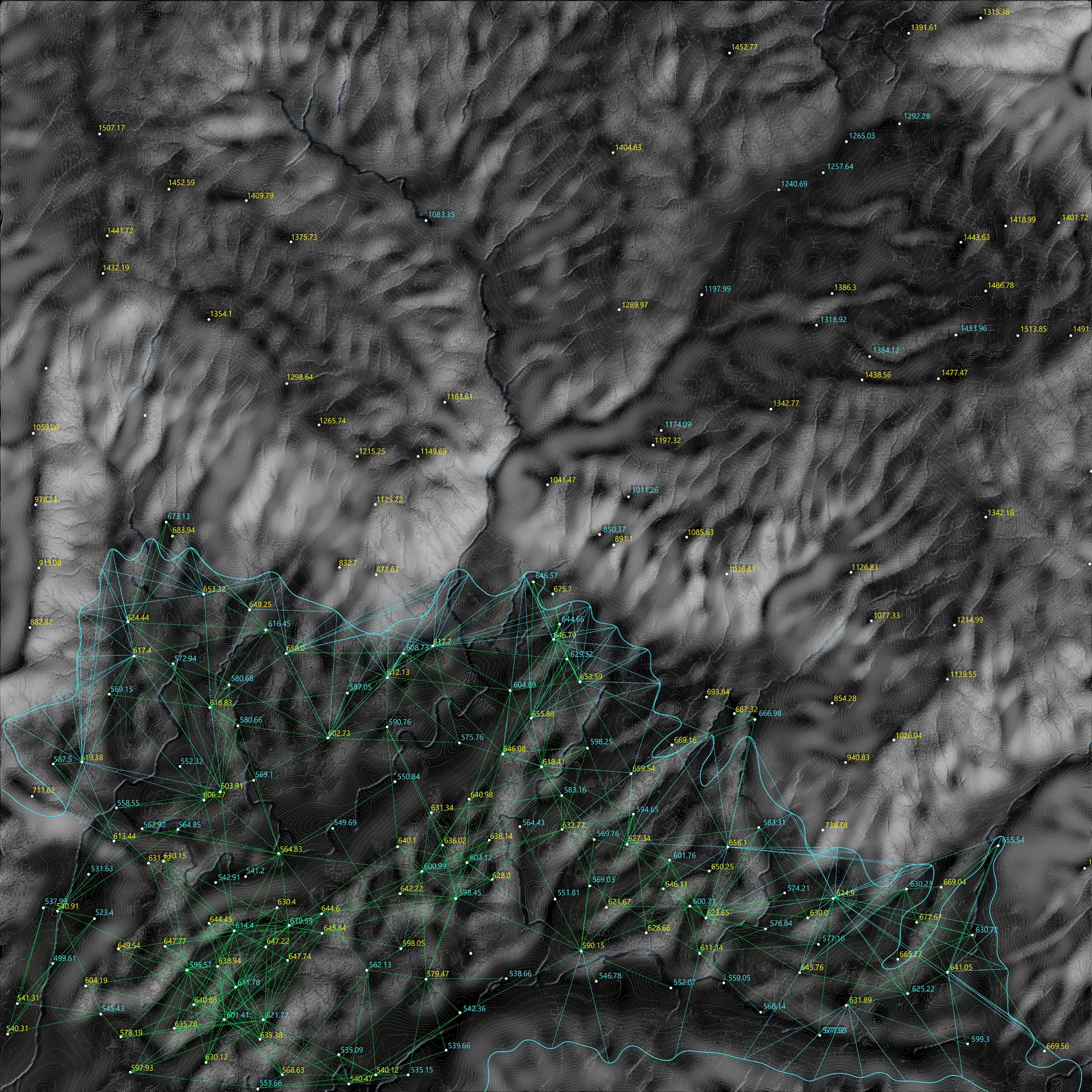
Furthermore these calculated connections are adapted to the topography, using machine learning, to translate this diagrammatic data into an artificial landscape that entirely follows the hydrology of the Kathmandu Valley.
This data based transformation of the landscape represents an optimized distribution of the existing landscape. As you can see all the steep parts of the topography which are the most vulnerable to landslides are now overgrown by vegetation to prevent them to further erode and cause economic damage to the inhabitants. At the same time the river course is optimized to the flow behaviour offering retention areas where water can accumulate, allowing groundwater recharge, to improve the overall hydrology of the valley. The distribution of the urban environment also follows the course of the flow lines making the whole city act as a drainage system. This allows a water distribution without any external input of energy which makes it safer against water related disasters.
Video
Gallery
University of Innsbruck 2020
IOUD - Synthetic Landscape Lab
Author:
Dipl.-Ing. Korbinian Enzinger
Supervisor:
Prof. Dr. Claudia Pasquero
MA Maria Kuptsova
External Examiner:
Dr. Marco Poletto